
- 1
- 1
- 1
- 1
- 1
- 1
- 1
- 1
- 1
- 1
- 1
- 1
- 1
- 1
The Mountains of the Moon: glaciers on the equator, giant lobelias, and day hikes with Bakonzo guides who call these slopes home.
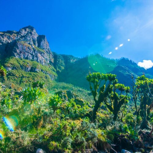
Rwenzori Mountains National Park runs along Uganda’s border with DR Congo in the west. It became a national park in 1991 and a UNESCO World Heritage Site in 1994. Its highest point, Margherita Peak on Mount Stanley, reaches 5,109 metres, the third highest peak in Africa.
People have called these the Mountains of the Moon for two thousand years. There are glaciers almost on the equator, mossy cloud forest, bamboo, and higher up, giant lobelias and groundsels taller than a person. It looks like nowhere else, and few travellers ever see it.
The Bakonzo people live on the slopes, and their culture is closely tied to the mountain. Near the Nyakalengija trailhead, Ruboni Community Camp is community-owned and run by Bakonzo hosts, with village walks, forest walks, local food, and music and dance in the evening. Guides and porters from the same villages know these slopes as home.
The driest months are late December to February and June to August. Rain is possible on any day of the year, so expect mud and bring good rain gear.
Allow 6 to 7 hours by road from Kampala to Kasese via Fort Portal, and about 1 hour more from Entebbe. Kasese has an airstrip for flights.
Summit climbs are Level 5, Strenuous: cold, high, wet and boggy, with glacier sections that need equipment and time to adjust to the altitude. Day hikes in the foothills are moderate. Wildlife is not the main reason to come: blue monkeys, colobus and forest birds are seen, but larger animals are rare. The Rwenzori pairs well with Queen Elizabeth or Kibale on the same trip. UWA’s current prices are valid to 31 December 2026; new UWA prices start on 1 January 2027.
The Mountains of the Moon: glaciers on the equator, giant lobelias, and day hikes with Bakonzo guides who call these slopes home.